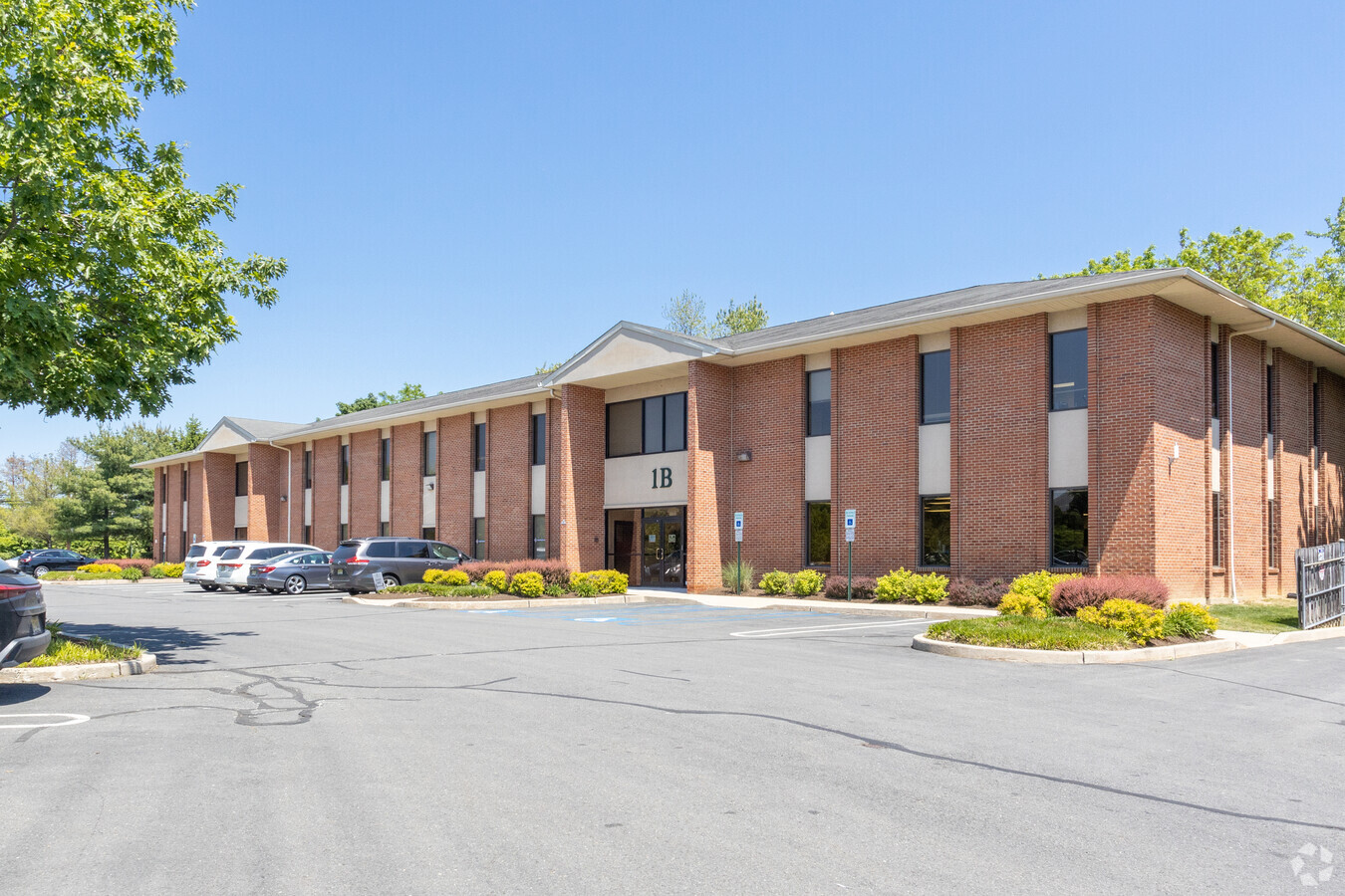
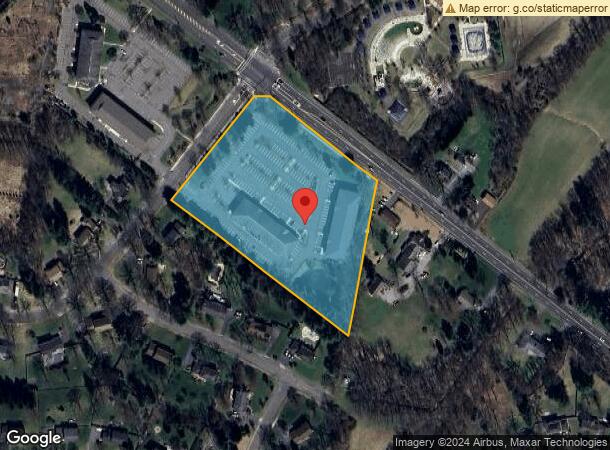
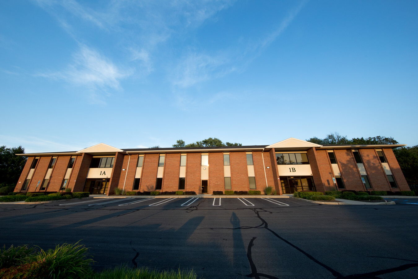
Property Record
196 Princeton Hightstown Rd, West Windsor, NJ 08550
Current Lease Availabilities
NEARBY LISTINGS FOR SALE OR LEASE
Property Detail
196 Princeton Hightstown Rd
Trenton, NJ
ALSO BLK 21D LOT 1 AND SLAYBACK DR
13-00021-06-00068
Mercer
Officebuilding
New Jersey
X
68
34021C0161F
5.16 AC
2023
Trenton
2024
Northern New Jersey
0043044002
DEMOGRAPHICS near 196 Princeton Hightstown Rd
1 Mile
3 Mile
5 Mile
2024 Total Population
4,436
40,368
113,593
2029 Population
4,351
39,636
112,697
Pop Growth 2024-2029
(1.92%)
(1.81%)
(0.79%)
Average Age
41
40
40
2024 Total Households
1,368
14,498
42,234
HH Growth 2024-2029
(2.12%)
(1.89%)
(0.79%)
Median Household Inc
$253,591
$151,562
$129,911
Avg Household Size
3.20
2.80
2.60
2024 Avg HH Vehicles
2.00
2.00
2.00
Median Home Value
$729,476
$648,493
$554,972
Median Year Built
1982
1985
1984
Nearby Places
- Restaurants
- Banks
- Shops
- Fitness
- Groceries
PUBLIC TRANSPORTATION
COMMUTER RAIL
Princeton Junction (Northeast Corridor Line - NJ Transit Commuter Rail (NJ Transit), Princeton Branch - NJ Transit Commuter Rail (NJ Transit))
DRIVE
WALK
Distance
Princeton Junction (Northeast Corridor Line - NJ Transit Commuter Rail (NJ Transit), Princeton Branch - NJ Transit Commuter Rail (NJ Transit))
6 min
2.3 mi
Princeton (Princeton Branch - NJ Transit Commuter Rail (NJ Transit))
DRIVE
WALK
Distance
Princeton (Princeton Branch - NJ Transit Commuter Rail (NJ Transit))
10 min
4.9 mi
AIRPORT
Trenton Mercer
DRIVE
WALK
Distance
Trenton Mercer
25 min
16.5 mi
Freight Ports
New York Container Terminal
DRIVE
WALK
Distance
New York Container Terminal
55 min
38.2 mi
Nearby Properties
Address
Land Use
TOTAL SIZE
Lot Size
Zoning
Address
Land Use
TOTAL SIZE
Lot Size
Zoning
636,000 SF
60.76 AC
PHCR
Address
Land Use
TOTAL SIZE
Lot Size
Zoning
58.63 AC
PMUD
Address
Land Use
TOTAL SIZE
Lot Size
Zoning
52.74 AC
PCD
Address
Land Use
TOTAL SIZE
Lot Size
Zoning
492,110 SF
58.48 AC
I100
Address
Land Use
TOTAL SIZE
Lot Size
Zoning
46.23 AC
PCD
Address
Land Use
TOTAL SIZE
Lot Size
Zoning
62.22 AC
PRN1
Address
Land Use
TOTAL SIZE
Lot Size
Zoning
64.36 AC
R4B
Address
Land Use
TOTAL SIZE
Lot Size
Zoning
42.53 AC
R-4B
Address
Land Use
TOTAL SIZE
Lot Size
Zoning
24.38 AC
ROM2
Address
Land Use
TOTAL SIZE
Lot Size
Zoning
2,448 SF
59.55 AC
RO
Address
Land Use
TOTAL SIZE
Lot Size
Zoning
25.66 AC
PHCR
Address
Land Use
TOTAL SIZE
Lot Size
Zoning
18.52 AC
ROM2
Address
Land Use
TOTAL SIZE
Lot Size
Zoning
89.76 AC
R100
Address
Land Use
TOTAL SIZE
Lot Size
Zoning
0.78 AC
PHCR
Address
Land Use
TOTAL SIZE
Lot Size
Zoning
49.96 AC
R24
Address
Land Use
TOTAL SIZE
Lot Size
Zoning
33.96 AC
PCD
Address
Land Use
TOTAL SIZE
Lot Size
Zoning
8.02 AC
ROM2
Address
Land Use
TOTAL SIZE
Lot Size
Zoning
6.10 AC
PHCR
Address
Land Use
TOTAL SIZE
Lot Size
Zoning
12.93 AC
ROM2
Address
Land Use
TOTAL SIZE
Lot Size
Zoning
6.17 AC
ROM2
Address
Land Use
TOTAL SIZE
Lot Size
Zoning
6.82 AC
ROM2
Address
Land Use
TOTAL SIZE
Lot Size
Zoning
14.07 AC
ROM1
Address
Land Use
TOTAL SIZE
Lot Size
Zoning
12.41 AC
ROM2
Address
Land Use
TOTAL SIZE
Lot Size
Zoning
6.85 AC
ROM1
Address
Land Use
TOTAL SIZE
Lot Size
Zoning
38.95 AC
R100
Address
Land Use
TOTAL SIZE
Lot Size
Zoning
11.91 AC
ROM2
Address
Land Use
TOTAL SIZE
Lot Size
Zoning
23.60 AC
R1
Address
Land Use
TOTAL SIZE
Lot Size
Zoning
8.94 AC
ROM2
Address
Land Use
TOTAL SIZE
Lot Size
Zoning
7.44 AC
ROM2
Address
Land Use
TOTAL SIZE
Lot Size
Zoning
161,588 SF
28 AC
RO
The World's #1 Commercial Real Estate Marketplace
Connect with us
© 2025 CoStar Group
The information above has been obtained from sources believed reliable. While we do not doubt its accuracy we have not verified it and make no guarantee, warranty or representation about it. It is your responsibility to independently confirm its accuracy and completeness. Any projections, opinions, assumptions, or estimates used are for example only and do not represent the current or future performance of the property. The value of this transaction to you depends on tax and other factors which should be evaluated by your tax, financial, and legal advisors. You and your advisors should conduct a careful, independent investigation of the property to determine to your satisfaction the suitability of the property for your needs.